Datoteka:Saint Vincent and the Grenadines relief location map.jpg

Veličina ovog prikaza: 477 × 599 piksela. Ostale rezolucije: 191 × 240 piksela | 382 × 480 piksela | 611 × 768 piksela | 1.060 × 1.332 piksela.
Izvorna datoteka (1.060 × 1.332 piksela, veličina datoteke: 194 KB, MIME tip: image/jpeg)
| Ova datoteka je s Wikimedia Commonsa. Opis s njene stranice opisa datoteke prikazan je ispod. Commons je skladište slobodnih medija i datoteka za sve projekte fondacije Wikimedia. Možete i Vi pomoći. |
| Opis |
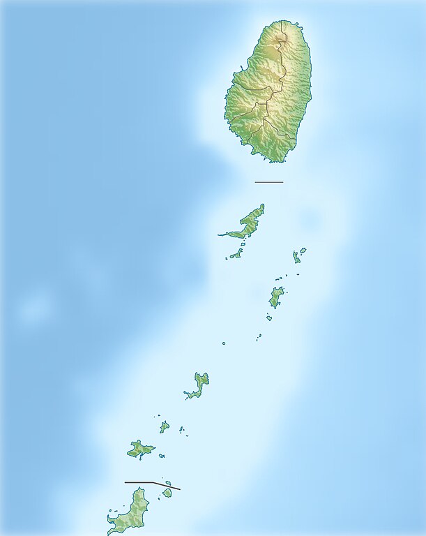
Deutsch: Physische Positionskarte von St. Vincent und die Grenadinen
Geographische Begrenzung der Karte:
English: Location map of Saint Vincent und the Grenadines
Geographic limits of the map:
|
| Datum | |
| Izvor |
Vlastito djelo, using
|
| Autor | Carport |
| Dopuštenje (Naknadno korištenje ove datoteke) |
Ova datoteka je licencirana pod Creative Commons Attribution-Share Alike 3.0 neportiranom licencom.
|
| Ostale verzije |
|

Historija datoteke
Kliknite na datum/vrijeme da vidite verziju datoteke iz tog vremena.
| Datum/vrijeme | Smanjeni pregled | Dimenzije | Korisnik | Komentar | |
|---|---|---|---|---|---|
| trenutno | 12:52, 1 januar 2013 | | 1.060 × 1.332 (194 KB) | Carport | {{Information |Description= {{de|Physische Positionskarte von St. Vincent und die Grenadinen}} Geographische Begrenzung der Karte: * N: 13.42° N * S: 12.44° N * W: 61.7° W * O: 60.9° W {{en|Location map of [[:... |
Upotreba datoteke
Sljedeća stranica koristi ovu datoteku:
Globalna upotreba datoteke
Sljedeći wikiji koriste ovu datoteku:
- Upotreba na ar.wikipedia.org
- Upotreba na ast.wikipedia.org
- Upotreba na az.wikipedia.org
- Upotreba na bg.wikipedia.org
- Upotreba na bn.wikipedia.org
- Upotreba na ceb.wikipedia.org
- Upotreba na da.wikipedia.org
- Upotreba na de.wikipedia.org
- St. Vincent und die Grenadinen
- Mustique
- Bequia
- Soufrière (St. Vincent)
- Union Island
- Canouan
- Tobago Cays
- Mayreau
- Palm Island (Grenadinen)
- Wikipedia:Kartenwerkstatt/Positionskarten/Nordamerika
- Petit St. Vincent
- Baliceaux
- Vorlage:Positionskarte St. Vincent und die Grenadinen
- Young Island (Grenadinen)
- Pigeon Island (Grenadinen)
- Saint Elairs Cay
- Samples Cay
- Grand Bonhomme
- All Awash Island
- Big Pillory
- Middle Pillory
- Little Pillory
- Rabbit Island (Grenadinen)
- Savan Island
- Little Savan
- Petit Canouan
- Petite Nevis
- Petite Mustique
- Isle à Quatre
- Wallilabou Bay
- Petit Bonhomme (St. Vincent)
- Mount Saint Andrew
- Milligan Cay
- Bettowia
- Church Cay
- Bullet (Grenadinen)
Pogledajte globalne upotrebe ove datoteke.