Datoteka:Map of the world by the US Gov as of 2016 no legend.svg

Veličina ovog PNG pregleda za ovu SVG datoteku: 800 × 405 piksela. Ostale rezolucije: 320 × 162 piksela | 640 × 324 piksela | 1.024 × 519 piksela | 1.280 × 648 piksela | 2.560 × 1.297 piksela | 3.464 × 1.755 piksela.
Izvorna datoteka (SVG datoteka, nominalno 3.464 × 1.755 piksela, veličina datoteke: 21,61 MB)
| Ova datoteka je s Wikimedia Commonsa. Opis s njene stranice opisa datoteke prikazan je ispod. Commons je skladište slobodnih medija i datoteka za sve projekte fondacije Wikimedia. Možete i Vi pomoći. |
Sažetak
| Opis |
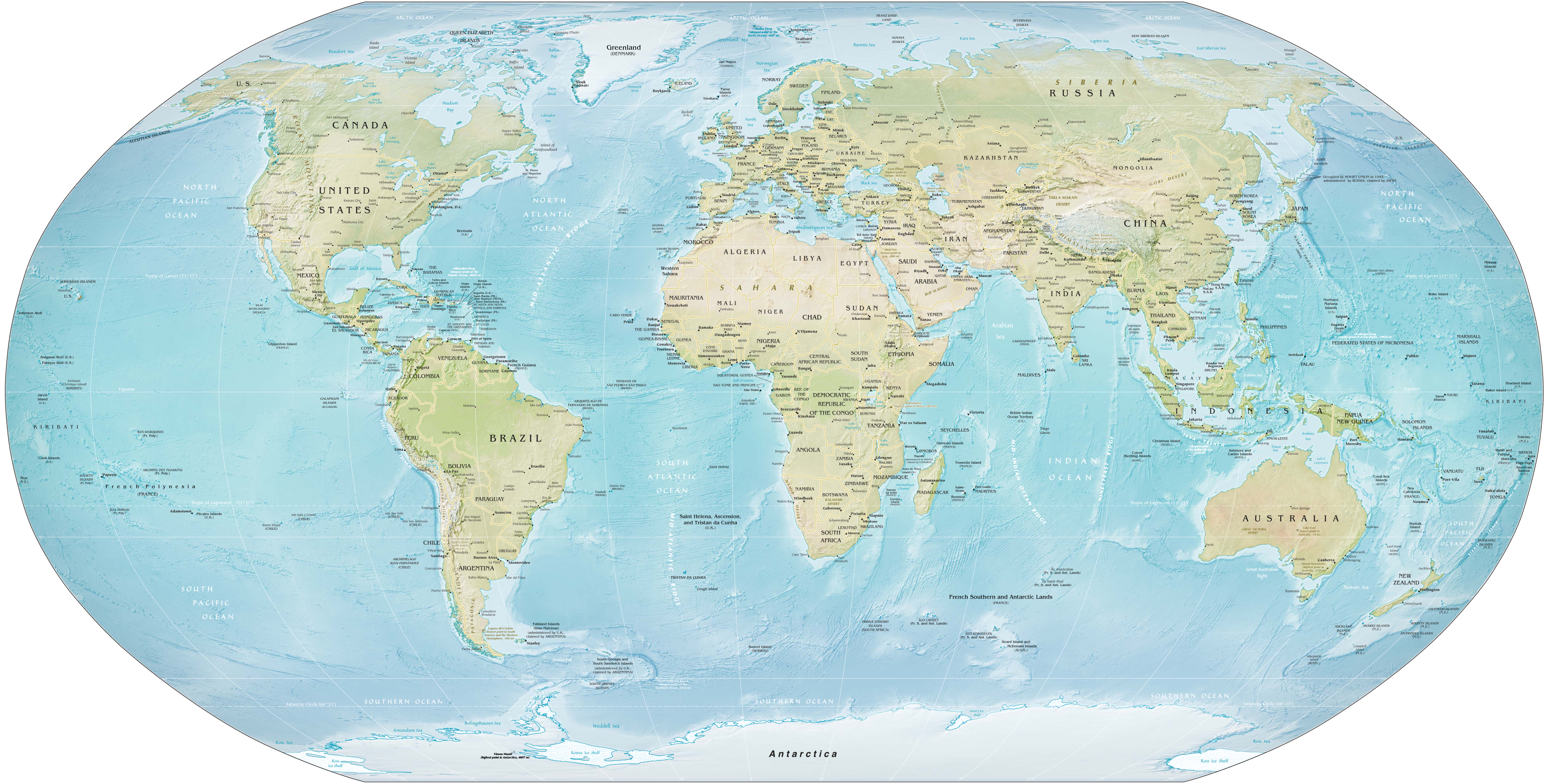
English: Map of the world as of February 2016. Robinson projection, standard parallels 38°N and 38°S. |
||
| Datum | |||
| Izvor | Derivative of Map of the world by the US Gov as of 2016.svg; originally from CIA World Factbook. | ||
| Autor | US Government, Central Intelligence Agency | ||
| Ostale verzije |
|
||
| SVG genesis |
|

|
Licenciranje
This work is in the public domain in the United States because it is a work prepared by an officer or employee of the United States Government as part of that person’s official duties under the terms of Title 17, Chapter 1, Section 105 of the US Code.
Note: This only applies to original works of the Federal Government and not to the work of any individual U.S. state, territory, commonwealth, county, municipality, or any other subdivision. This template also does not apply to postage stamp designs published by the United States Postal Service since 1978. (See § 313.6(C)(1) of Compendium of U.S. Copyright Office Practices). It also does not apply to certain US coins; see The US Mint Terms of Use.
|
 | |
| Ova datoteka je identificirana kao slobodna od poznatih ograničenja po zakonu o autorskim pravima, uključujući sva povezana i srodna prava. | ||
Historija datoteke
Kliknite na datum/vrijeme da vidite verziju datoteke iz tog vremena.
| Datum/vrijeme | Smanjeni pregled | Dimenzije | Korisnik | Komentar | |
|---|---|---|---|---|---|
| trenutno | 19:12, 28 januar 2021 | | 3.464 × 1.755 (21,61 MB) | Ravenpuff | Fix clip |
| 18:51, 28 januar 2021 |  | 3.464 × 1.755 (21,61 MB) | Ravenpuff | Clip out white background from raster image of map | |
| 06:19, 9 juli 2019 |  | 3.464 × 1.755 (21,6 MB) | Kaldari | Fixing label for Rub' al Khali Desert | |
| 17:32, 8 juli 2019 |  | 3.464 × 1.755 (21,6 MB) | Kaldari | Removing random square under Ross Sea label | |
| 17:16, 8 juli 2019 |  | 3.464 × 1.755 (21,42 MB) | Kaldari | User created page with UploadWizard |
Upotreba datoteke
Sljedeća stranica koristi ovu datoteku:
Globalna upotreba datoteke
Sljedeći wikiji koriste ovu datoteku:
- Upotreba na ar.wikipedia.org
- Upotreba na bbc.wikipedia.org
- Upotreba na bcl.wikipedia.org
- Upotreba na bn.wikipedia.org
- Upotreba na br.wikipedia.org
- Upotreba na en.wikipedia.org
- Talk:Robinson projection
- Wikipedia:Featured pictures/Diagrams, drawings, and maps/Maps
- Wikipedia:Featured picture candidates/July-2019
- Wikipedia:Featured pictures thumbs/65
- Wikipedia:Featured picture candidates/Map of the world by the US Gov
- User talk:Kaldari/Archive 24
- Wikipedia:Picture of the day/February 2021
- Template:POTD/2021-02-01
- User:Northamerica1000/Topics
- Portal:Geography/Selected picture
- Wikipedia:Main Page history/2021 February 1
- Wikipedia:Main Page history/2021 February 1b
- User:Kuevans/Introduction to Comparative Politics
- Upotreba na es.wikipedia.org
- Upotreba na ff.wikipedia.org
- Upotreba na ha.wikipedia.org
- Upotreba na hi.wikipedia.org
- Upotreba na hi.wikibooks.org
- Upotreba na hy.wikipedia.org
- Upotreba na id.wiktionary.org
- Upotreba na incubator.wikimedia.org
- Upotreba na mk.wikipedia.org
- Upotreba na ms.wikipedia.org
- Upotreba na ps.wikipedia.org
- Upotreba na si.wikipedia.org
- Upotreba na vec.wikipedia.org
- Upotreba na za.wikipedia.org
- Upotreba na zh.wikipedia.org