Datoteka:Map of Pennsylvania NA.png
Veličina ovog prikaza: 776 × 600 piksela. Ostale rezolucije: 311 × 240 piksela | 621 × 480 piksela | 994 × 768 piksela | 1.280 × 989 piksela | 2.122 × 1.640 piksela.
Izvorna datoteka (2.122 × 1.640 piksela, veličina datoteke: 2,56 MB, MIME tip: image/png)
| Ova datoteka je s Wikimedia Commonsa. Opis s njene stranice opisa datoteke prikazan je ispod. Commons je skladište slobodnih medija i datoteka za sve projekte fondacije Wikimedia. Možete i Vi pomoći. |
Sažetak
| Opis |
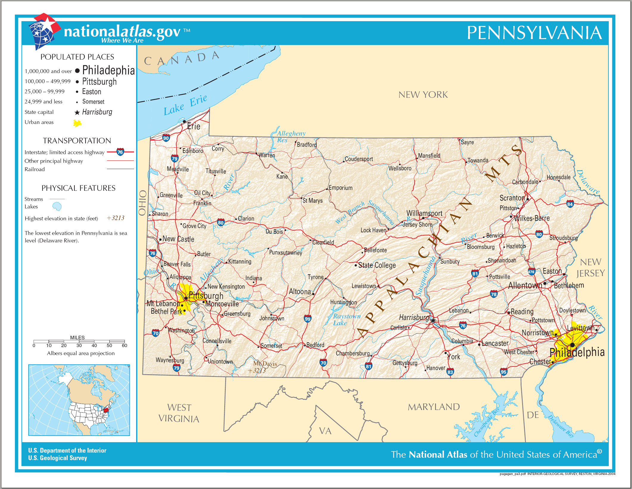
English: Map of Pennsylvania. |
| Datum | |
| Izvor | National Atlas |
| Autor |
Licenciranje
This map was obtained from an edition of the National Atlas of the United States. Like almost all works of the U.S. federal government, works from the National Atlas are in the public domain in the United States.
Online access: NationalAtlas.gov | 1970 print edition: Library of Congress, Perry-Castañeda Library
|
Historija datoteke
Kliknite na datum/vrijeme da vidite verziju datoteke iz tog vremena.
| Datum/vrijeme | Smanjeni pregled | Dimenzije | Korisnik | Komentar | |
|---|---|---|---|---|---|
| trenutno | 11:40, 15 august 2006 | | 2.122 × 1.640 (2,56 MB) | Huebi~commonswiki | {{Information| |Description=Map of Pennsylvania |Source=[http://www.nationalatlas.gov National Atlas] }} Category:Maps of the United States Category:Maps of Pennsylvania {{PD-USGov-Atlas}} |
Upotreba datoteke
Sljedeće 3 stranice koriste ovu datoteku:
Globalna upotreba datoteke
Sljedeći wikiji koriste ovu datoteku:
- Upotreba na als.wikipedia.org
- Upotreba na ar.wikipedia.org
- Upotreba na bn.wikipedia.org
- Upotreba na ca.wikipedia.org
- Upotreba na de.wikipedia.org
- Upotreba na en.wikipedia.org
- Upotreba na fi.wikipedia.org
- Upotreba na fr.wikipedia.org
- Upotreba na hi.wikipedia.org
- Upotreba na hr.wiktionary.org
- Upotreba na hsb.wikipedia.org
- Upotreba na hu.wikipedia.org
- Upotreba na ilo.wikipedia.org
- Upotreba na incubator.wikimedia.org
- Upotreba na it.wikipedia.org
- Upotreba na lt.wikipedia.org
- Upotreba na ru.wikivoyage.org
- Upotreba na simple.wikipedia.org
- Upotreba na si.wikipedia.org
- Upotreba na sw.wikipedia.org
- Upotreba na szl.wikipedia.org
- Upotreba na zea.wikipedia.org