Datoteka:Map-antarctica-ross-ice-shelf-red-x.png
Veća rezolucija nije dostupna.
Map-antarctica-ross-ice-shelf-red-x.png (316 × 313 piksela, veličina datoteke: 26 KB, MIME tip: image/png)
| Ova datoteka je s Wikimedia Commonsa. Opis s njene stranice opisa datoteke prikazan je ispod. Commons je skladište slobodnih medija i datoteka za sve projekte fondacije Wikimedia. Možete i Vi pomoći. |
| Opis |
|
| Datum | (UTC) |
| Izvor | |
| Autor |
|
| Ostale verzije | Derivative works of this file: Antarctica map indicating Antarctic Peninsula.JPG |
| This is a retouched picture, which means that it has been digitally altered from its original version. Modifications: Cropped, put in red X on the Ross ice shelf.. The original can be viewed here: Antarctica Map.png:
|
This image is in the public domain because it contains materials that originally came from the United States Central Intelligence Agency's World Factbook.
|
 |
Originalni zapisnik postavljanja
This image is a derivative work of the following images:
- File:Antarctica_Map.png licensed with PD-USGov-CIA-WF
- 2004-12-15T23:16:35Z Mschlindwein 502x617 (53433 Bytes)
Uploaded with derivativeFX
Historija datoteke
Kliknite na datum/vrijeme da vidite verziju datoteke iz tog vremena.
| Datum/vrijeme | Smanjeni pregled | Dimenzije | Korisnik | Komentar | |
|---|---|---|---|---|---|
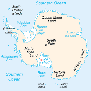
| trenutno | 19:22, 16 februar 2009 | | 316 × 313 (26 KB) | Jeandré du Toit | {{Information |Description=*Map of Antarctica with a red X on the Ross ice shelf. |Source=*File:Antarctica_Map.png |Date=2009-02-16 17:20 (UTC) |Author=*File:Antarctica_Map.png *derivative work: ~~~ |Permission=see below |other_versions= }} { |
Upotreba datoteke
Nema stranica koje koriste ovu datoteku.
Globalna upotreba datoteke
Sljedeći wikiji koriste ovu datoteku:
- Upotreba na en.wikipedia.org
- Upotreba na fi.wikipedia.org
- Upotreba na gv.wikipedia.org
- Upotreba na id.wikipedia.org
- Upotreba na ja.wikipedia.org
- Upotreba na mk.wikipedia.org
- Upotreba na ms.wikipedia.org
- Upotreba na pt.wikipedia.org
- Upotreba na zh.wikipedia.org