Datoteka:Earth from Space.jpg
Veličina ovog prikaza: 600 × 600 piksela. Ostale rezolucije: 240 × 240 piksela | 480 × 480 piksela | 768 × 768 piksela | 1.024 × 1.024 piksela | 2.048 × 2.048 piksela | 4.096 × 4.096 piksela.
Izvorna datoteka (4.096 × 4.096 piksela, veličina datoteke: 1,84 MB, MIME tip: image/jpeg)
| Ova datoteka je s Wikimedia Commonsa. Opis s njene stranice opisa datoteke prikazan je ispod. Commons je skladište slobodnih medija i datoteka za sve projekte fondacije Wikimedia. Možete i Vi pomoći. |
Sažetak
| Opis |
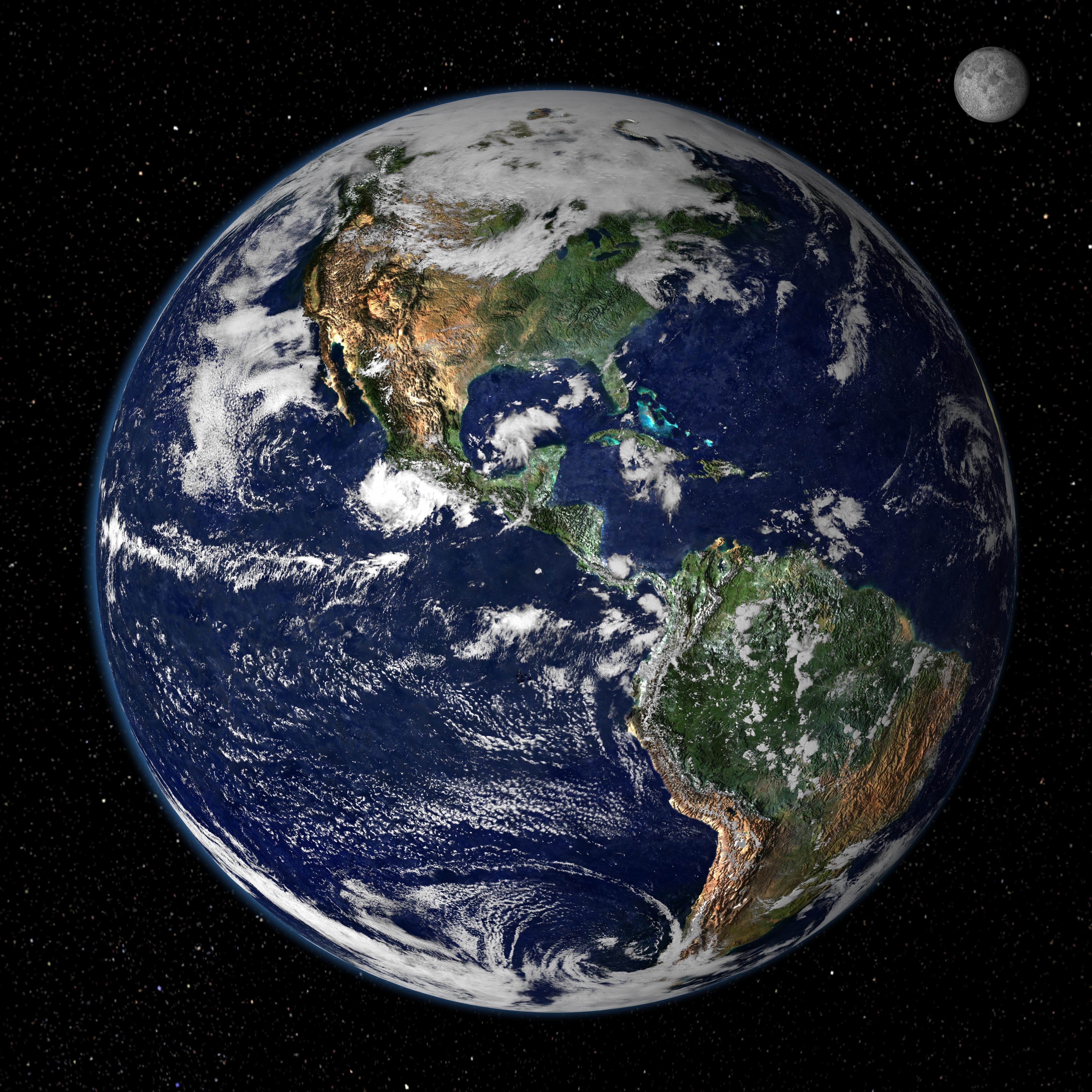
English: This true-color image shows North and South America as they would appear from space 35,000 km (22,000 miles) above the Earth. The image is a combination of data from two satellites. The Moderate Resolution Imaging Spectroradiometer (MODIS) instrument aboard NASA’s Terra satellite collected the land surface data over 16 days, while NOAA’s Geostationary Operational Environmental Satellite (GOES) produced a snapshot of the Earth’s clouds. |
| Datum | |
| Izvor | http://earthobservatory.nasa.gov/IOTD/view.php?id=885 |
| Autor | NASA/GSFC/Reto Stöckli, Nazmi El Saleous, and Marit Jentoft-Nilsen |
Licenciranje
| This file is in the public domain in the United States because it was solely created by NASA. NASA copyright policy states that "NASA material is not protected by copyright unless noted". (See Template:PD-USGov, NASA copyright policy page or JPL Image Use Policy.) | ||
 |
Warnings:
|
Historija datoteke
Kliknite na datum/vrijeme da vidite verziju datoteke iz tog vremena.
| Datum/vrijeme | Smanjeni pregled | Dimenzije | Korisnik | Komentar | |
|---|---|---|---|---|---|
| trenutno | 15:02, 14 august 2007 | | 4.096 × 4.096 (1,84 MB) | Shizhao | from http://earthobservatory.nasa.gov/Newsroom/NewImages/images.php3?img_id=4231 This true-color image shows North and South America as they would appear from space 35,000 km (22,000 miles) above the Earth. The image is a combination of data from two sat |
Upotreba datoteke
Sljedeća stranica koristi ovu datoteku:
Globalna upotreba datoteke
Sljedeći wikiji koriste ovu datoteku:
- Upotreba na de.wikiquote.org
- Upotreba na en.wikipedia.org
- Upotreba na en.wikiquote.org
- Upotreba na en.wikiversity.org
- Upotreba na fr.wikipedia.org
- Upotreba na sv.wikivoyage.org