Datoteka:Historisch Nordamerika.jpg
Veličina ovog prikaza: 731 × 600 piksela. Ostale rezolucije: 293 × 240 piksela | 585 × 480 piksela | 936 × 768 piksela | 1.248 × 1.024 piksela | 2.497 × 2.048 piksela | 2.560 × 2.100 piksela.
Izvorna datoteka (2.560 × 2.100 piksela, veličina datoteke: 6,03 MB, MIME tip: image/jpeg)
| Ova datoteka je s Wikimedia Commonsa. Opis s njene stranice opisa datoteke prikazan je ispod. Commons je skladište slobodnih medija i datoteka za sve projekte fondacije Wikimedia. Možete i Vi pomoći. |
Sažetak
| Opis |
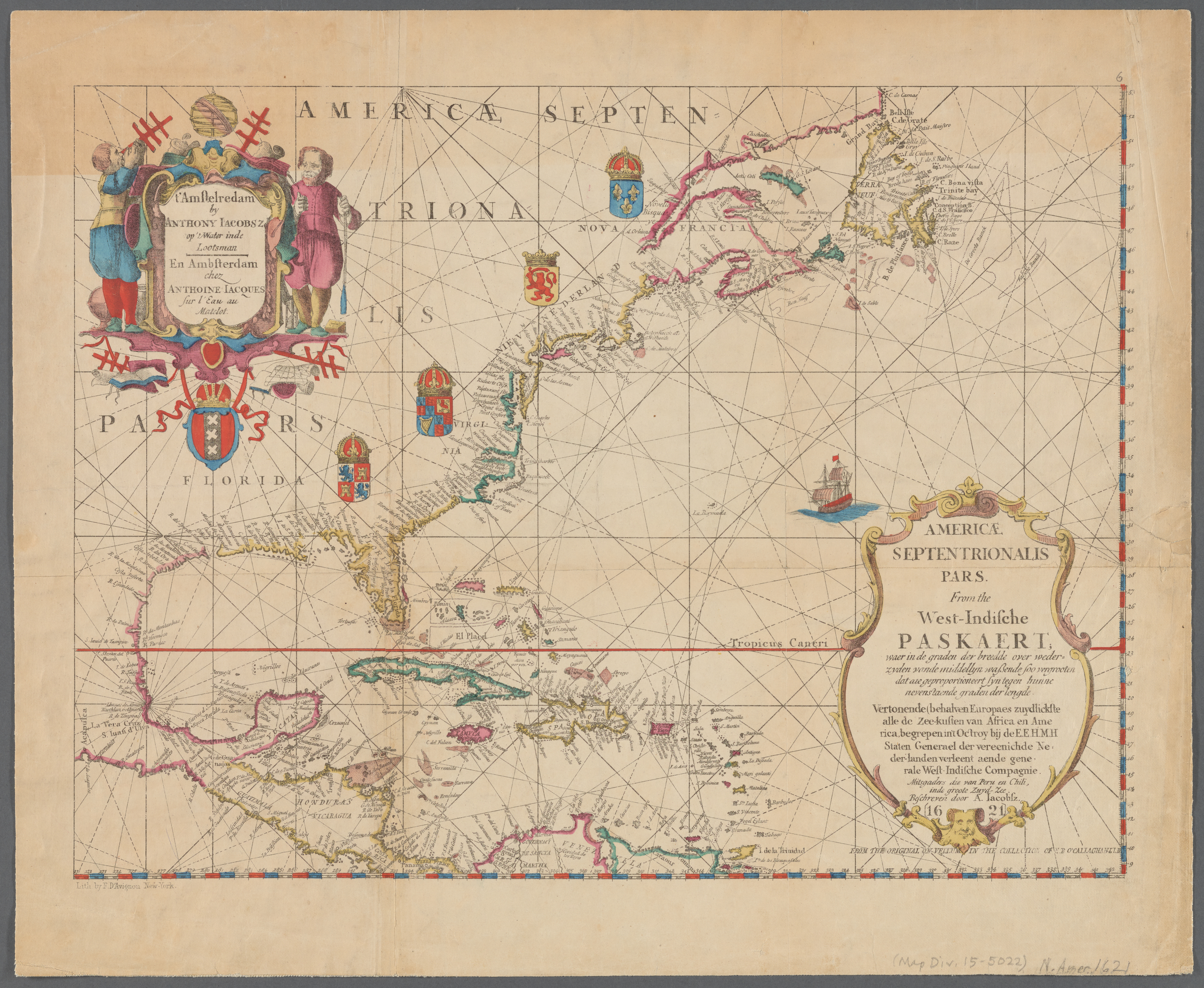
English: Old map of North America, the Caribbean, and northern South America; covers area north from Venezuela to Labrador; includes decorative cartouches and illustrations. This is a facsimile, from the original on vellum in the collection of E.B. O'Callaghan LLD.
|
||
| Datum | |||
| Izvor |
|
||
| Autor |
Anthoni Jacobsz (1594-1624), cartographer Francis D'Avignon (1813–1875), lithographer E.B. (Edmund Bailey) O'Callaghan (1797–1880), collector |
||
| Ostale verzije |
|
.jpg)

.jpg)
Licenciranje
|
This work is in the public domain in its country of origin and other countries and areas where the copyright term is the author's life plus 100 years or fewer. This work is in the public domain in the United States because it was published (or registered with the U.S. Copyright Office) before January 1, 1929. | |
| Ova datoteka je identificirana kao slobodna od poznatih ograničenja po zakonu o autorskim pravima, uključujući sva povezana i srodna prava. | |
Historija datoteke
Kliknite na datum/vrijeme da vidite verziju datoteke iz tog vremena.
| Datum/vrijeme | Smanjeni pregled | Dimenzije | Korisnik | Komentar | |
|---|---|---|---|---|---|
| trenutno | 01:55, 11 januar 2021 | | 2.560 × 2.100 (6,03 MB) | Vzeebjtf | larger, higher resolution |
| 23:43, 13 septembar 2013 |  | 400 × 314 (83 KB) | Gladiool | Same image, higher quality. | |
| 22:14, 2 oktobar 2005 |  | 382 × 269 (38 KB) | Newsflash | 16 or 17 century old map |
Upotreba datoteke
Nema stranica koje koriste ovu datoteku.
Globalna upotreba datoteke
Sljedeći wikiji koriste ovu datoteku:
- Upotreba na bn.wikipedia.org
- Upotreba na ka.wikipedia.org
- Upotreba na km.wikipedia.org