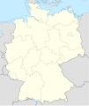
Datoteka:Germany location map.svg
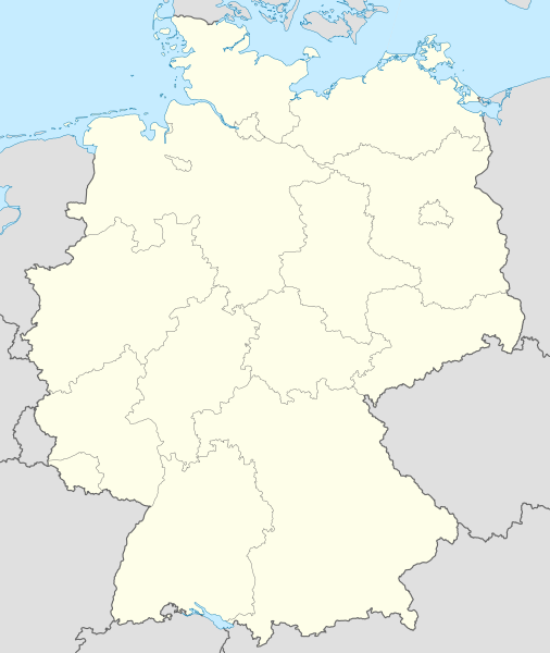
Veličina ovog PNG pregleda za ovu SVG datoteku: 506 × 600 piksela. Ostale rezolucije: 202 × 240 piksela | 405 × 480 piksela | 648 × 768 piksela | 864 × 1.024 piksela | 1.728 × 2.048 piksela | 1.073 × 1.272 piksela.
Izvorna datoteka (SVG datoteka, nominalno 1.073 × 1.272 piksela, veličina datoteke: 452 KB)
Historija datoteke
Kliknite na datum/vrijeme da vidite verziju datoteke iz tog vremena.
| Datum/vrijeme | Smanjeni pregled | Dimenzije | Korisnik | Komentar | |
|---|---|---|---|---|---|
| trenutno | 14:51, 16 septembar 2013 |  | 1.073 × 1.272 (452 KB) | SokoWiki | Clearer borders. |
| 10:34, 16 septembar 2013 |  | 1.073 × 1.272 (452 KB) | NordNordWest | Reverted to version as of 12:32, 2 October 2012; didn't make anything better | |
| 10:34, 16 septembar 2013 |  | 1.073 × 1.272 (452 KB) | NordNordWest | Reverted to version as of 12:32, 2 October 2012; didn't make anything better | |
| 22:08, 15 septembar 2013 |  | 1.073 × 1.272 (451 KB) | SokoWiki | * | |
| 14:32, 2 oktobar 2012 |  | 1.073 × 1.272 (452 KB) | Palosirkka | Reverted to version as of 20:14, 5 August 2012 Location maps must remain very accurate | |
| 07:40, 2 oktobar 2012 |  | 1.073 × 1.272 (396 KB) | Palosirkka | Scrubbed with http://codedread.com/scour/ | |
| 22:14, 5 august 2012 |  | 1.073 × 1.272 (452 KB) | NordNordWest | upd | |
| 12:03, 19 januar 2010 |  | 1.073 × 1.272 (490 KB) | NordNordWest | update | |
| 10:33, 22 juli 2009 |  | 1.075 × 1.273 (608 KB) | NordNordWest | c | |
| 16:36, 13 oktobar 2008 |  | 1.075 × 1.273 (606 KB) | NordNordWest |
Upotreba datoteke
Sljedećih 48 stranica koristi ovu datoteku:
- Aach (Baden-Württemberg)
- Berlin
- Bremen
- Bundesliga
- Darmstadt
- Dessau-Roßlau
- Dresden
- Dudweiler
- Düsseldorf
- Erfurt
- Essen
- Esslingen am Neckar
- Evropsko prvenstvo u nogometu 2024.
- Evropsko prvenstvo u rukometu 2024.
- Frankfurt na Majni
- Glücksburg
- Göppingen
- Hamburg
- Hannover
- Horumersiel
- Husum
- Landshut
- Leipzig
- Leverkusen
- Njemačke savezne pokrajine
- Nogometna Bundesliga 2013/2014.
- Nogometna Bundesliga 2016/2017.
- Nogometna Bundesliga 2017/2018.
- Nogometna Bundesliga 2018/2019.
- Oberhausen
- Oberstdorf
- Quierschied
- Reutlingen
- Saarbrücken
- Saarlouis
- Stuttgart
- Svjetsko prvenstvo u nogometu 2006.
- Wittenberg
- Wolfsburg
- Razgovor:Nogometna Bundesliga 2009/2010.
- Šablon:Infokutija naselje u Njemačkoj
- Šablon:Infokutija naselje u Njemačkoj/dok
- Šablon:Lokacijska karta Njemačka
- Šablon:Njemačke pokrajine
- Modul:Location map/data/Deutschland
- Modul:Location map/data/Germany
- Modul:Location map/data/Germany/dok
- Modul:Location map/data/Njemačka
Globalna upotreba datoteke
Sljedeći wikiji koriste ovu datoteku:
- Upotreba na af.wikipedia.org
- Upotreba na als.wikipedia.org
- Weil der Stadt
- Schopfheim
- Rheinfelden (Baden)
- Rümmingen
- Lörrach
- Kehl
- Steinen (Baden)
- Weil am Rhein
- Bad Säckingen
- Freiburg im Breisgau
- Schwörstadt
- Augsburg
- Zell im Wiesental
- Maulburg
- Offenburg
- Ötigheim
- Hamburg
- Renchen
- Konstanz
- Furtwangen im Schwarzwald
- Görwihl
- Ebringen
- Müllheim im Markgräflerland
- Pfaffenweiler
- Calw
- Au (Breisgau)
- Merzhausen
- Sölden (Schwarzwald)
- Schallstadt
- Bollschweil
- Ehrenkirchen
- Wittnau (Breisgau)
- Vörstetten
- Achern
- Wehr (Baden)
- Vogtsburg im Kaiserstuhl
Pogledajte globalne upotrebe ove datoteke.


