Datoteka:Estonia municipalities.png

Veličina ovog prikaza: 800 × 513 piksela. Ostale rezolucije: 320 × 205 piksela | 640 × 411 piksela | 1.024 × 657 piksela | 1.280 × 821 piksela | 1.601 × 1.027 piksela.
Izvorna datoteka (1.601 × 1.027 piksela, veličina datoteke: 82 KB, MIME tip: image/png)
| Ova datoteka je s Wikimedia Commonsa. Opis s njene stranice opisa datoteke prikazan je ispod. Commons je skladište slobodnih medija i datoteka za sve projekte fondacije Wikimedia. Možete i Vi pomoći. |
Sažetak
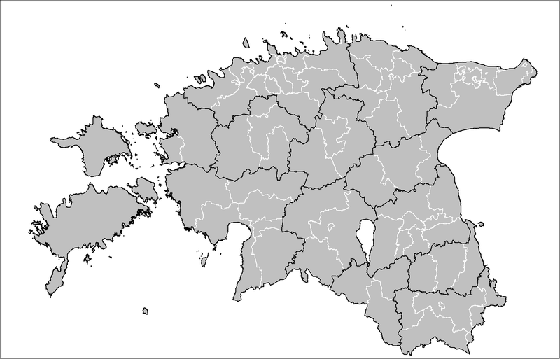
| Opis | Map of the municipalities of Estonia after the 2017 municipal reform. Created by Rarelibra 15:43, 20 December 2006 (UTC) for public domain use, using MapInfo Professional v8.5 and various mapping resources. |
| Datum | 20 decembar 2006 (original upload date) |
| Izvor | No machine-readable source provided. Own work assumed (based on copyright claims). |
| Autor | No machine-readable author provided. Rarelibra assumed (based on copyright claims). |

|
This image could be re-created using vector graphics as an SVG file. This has several advantages; see Commons:Media for cleanup for more information. If an SVG form of this image is available, please upload it and afterwards replace this template with
{{vector version available|new image name}}.
It is recommended to name the SVG file “Estonia municipalities.svg”—then the template Vector version available (or Vva) does not need the new image name parameter. |
Licenciranje
| Ja, vlasnik autorskog prava ovog djela, objavljujem ovaj rad u javno vlasništvo. Ovo se primjenjuje u cijelom svijetu. U nekim državama ovo zakonski nije moguće; u tom slučaju: Ja dopuštam svima pravo korištenja ovog rada u bilo koju svrhu, bez ikakvih uslova, osim ako su takvi uslovi zakonski neophodni. |
Historija datoteke
Kliknite na datum/vrijeme da vidite verziju datoteke iz tog vremena.
| Datum/vrijeme | Smanjeni pregled | Dimenzije | Korisnik | Komentar | |
|---|---|---|---|---|---|
| trenutno | 21:50, 8 april 2019 | | 1.601 × 1.027 (82 KB) | H2ppyme | Fixed Kohila Parish |
| 16:51, 8 decembar 2017 |  | 1.601 × 1.027 (72 KB) | RoMex | Updated according to the 2017 municipal reform. | |
| 09:33, 10 mart 2017 |  | 1.601 × 1.027 (102 KB) | H2ppyme | Corrected borders of Põlva and Rakvere parishes and Võhma Town. | |
| 03:44, 4 januar 2015 |  | 1.601 × 1.027 (122 KB) | Flying Saucer | updated Lääne-Saare Parish | |
| 01:35, 26 oktobar 2013 |  | 1.601 × 1.027 (122 KB) | Flying Saucer | October 2013 updates | |
| 14:30, 2 septembar 2010 |  | 1.601 × 1.027 (110 KB) | H2ppyme | Kaisma Parish merged with Vändra Parish | |
| 15:40, 24 mart 2008 |  | 1.601 × 1.027 (76 KB) | Rarelibra | updated map style | |
| 19:39, 8 januar 2007 |  | 1.281 × 878 (56 KB) | Rarelibra | Updated map of the municipalities of Estonia (due to 2006 updates). | |
| 17:43, 20 decembar 2006 |  | 1.281 × 878 (41 KB) | Rarelibra | Map of the municipalities of Estonia. Created by ~~~~ for public domain use, using MapInfo Professional v8.5 and various mapping resources. |
Upotreba datoteke
Sljedeća stranica koristi ovu datoteku:
Globalna upotreba datoteke
Sljedeći wikiji koriste ovu datoteku:
- Upotreba na ar.wikipedia.org
- Upotreba na arz.wikipedia.org
- Upotreba na ba.wikipedia.org
- Upotreba na bn.wikipedia.org
- Upotreba na ca.wikipedia.org
- Upotreba na ceb.wikipedia.org
- Upotreba na cs.wikipedia.org
- Upotreba na da.wikipedia.org
- Upotreba na de.wikipedia.org
- Upotreba na el.wikipedia.org
- Upotreba na en.wikipedia.org
- Upotreba na et.wikipedia.org
- Eesti
- Eesti külade loend
- Arutelu:Eesti
- Eesti haldusüksuste lippude loend
- Eesti haldusjaotus
- URBACT
- Eesti regionaalpoliitika
- Eesti omavalitsuste haldusreform
- Eesti haldusüksuste vappide loend
- Vikipeedia arutelu:Vikiprojekt KOV 2017
- Kasutaja:Telempe/Mall:KOV2017
- Mall:Eesti maakondade lippude kaart
- Mall:Eesti maakondade vappide kaart
- Upotreba na fa.wikipedia.org
- Upotreba na fiu-vro.wikipedia.org
- Upotreba na fi.wikipedia.org
- Upotreba na fr.wikipedia.org
- Upotreba na hu.wikipedia.org
- Upotreba na it.wikipedia.org
- Upotreba na ja.wikipedia.org
- Upotreba na ka.wikipedia.org
- Upotreba na la.wikipedia.org
- Upotreba na mk.wikipedia.org
- Upotreba na my.wikipedia.org
- Upotreba na nl.wikipedia.org
- Upotreba na nn.wikipedia.org
- Upotreba na no.wikipedia.org
- Upotreba na pl.wikipedia.org
Pogledajte globalne upotrebe ove datoteke.