Datoteka:Canada.A2002160.1920.721.250m.jpg
Veličina ovog prikaza: 712 × 600 piksela. Ostale rezolucije: 285 × 240 piksela | 570 × 480 piksela | 912 × 768 piksela | 1.216 × 1.024 piksela | 2.432 × 2.048 piksela | 2.914 × 2.454 piksela.
Izvorna datoteka (2.914 × 2.454 piksela, veličina datoteke: 1,82 MB, MIME tip: image/jpeg)
| Ova datoteka je s Wikimedia Commonsa. Opis s njene stranice opisa datoteke prikazan je ispod. Commons je skladište slobodnih medija i datoteka za sve projekte fondacije Wikimedia. Možete i Vi pomoći. |
Sažetak
| Opis |
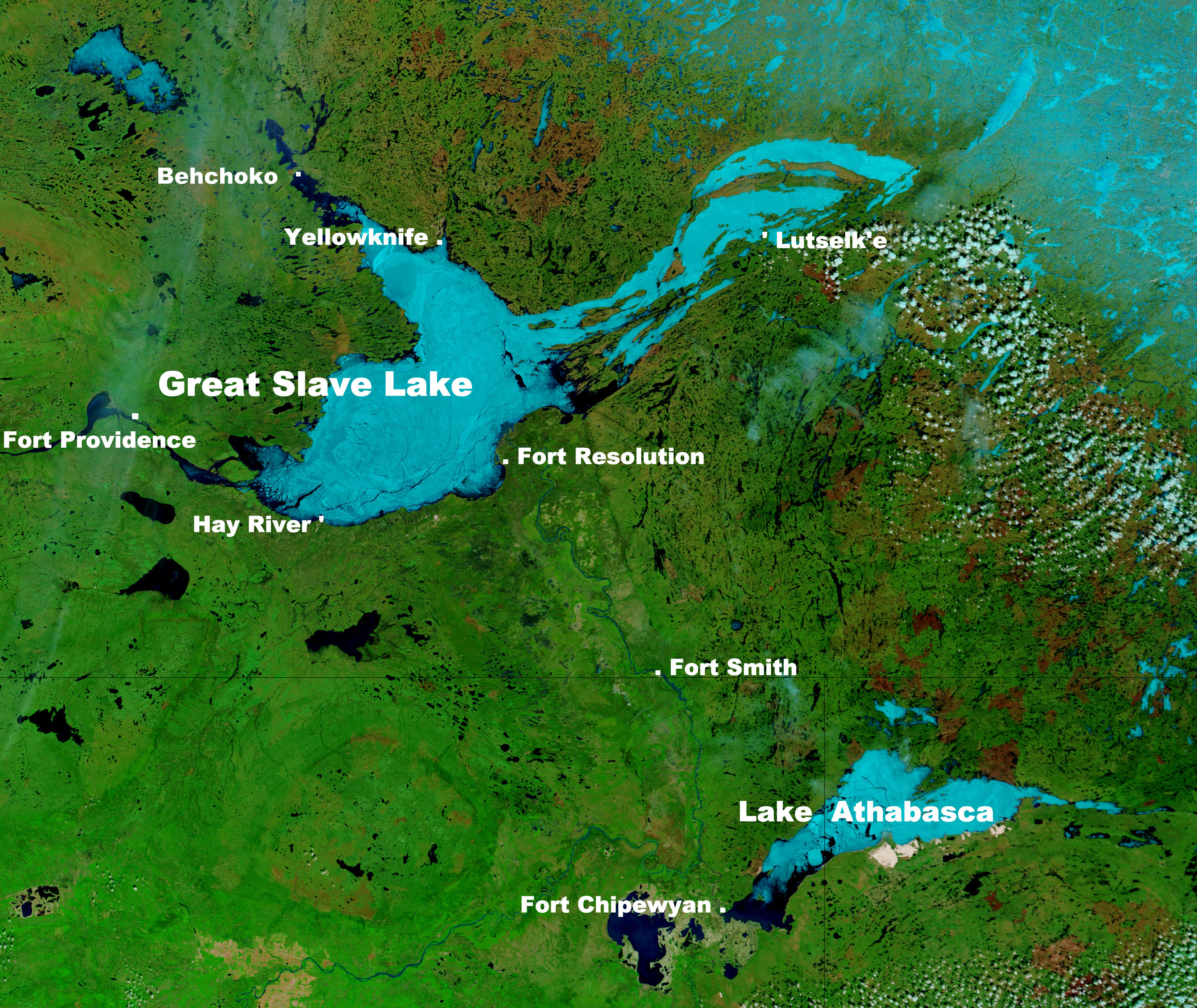
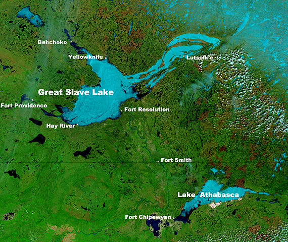
English: These true- and false-color images of central Canada show the Great Slave Lake in the Northwest Territories (top) and Lake Athabasca to the southeast. Lake Athabasca straddles the border between Alberta (west) and Saskatchewan (east). A fire (red dot) is burning in Alberta, and the snow capped Rocky Mountains cut through southwest Alberta at bottom left. In the false-color image, vegetation is green, water is dark blue, and ice (or snow) is light blue.
(Captions added by Kayoty) |
| Datum | |
| Izvor | Nasa (Visible Earth) |
| Autor | Jacques Descloitres, MODIS Land Rapid Response Team, NASA/GSFC |
Licenciranje
| This file is in the public domain in the United States because it was solely created by NASA. NASA copyright policy states that "NASA material is not protected by copyright unless noted". (See Template:PD-USGov, NASA copyright policy page or JPL Image Use Policy.) | ||
 |
Warnings:
|
Historija datoteke
Kliknite na datum/vrijeme da vidite verziju datoteke iz tog vremena.
| Datum/vrijeme | Smanjeni pregled | Dimenzije | Korisnik | Komentar | |
|---|---|---|---|---|---|
| trenutno | 12:17, 16 septembar 2014 | | 2.914 × 2.454 (1,82 MB) | Kayoty | added Behchoko to map |
| 11:33, 16 septembar 2014 |  | 2.914 × 2.454 (1,82 MB) | Kayoty | User created page with UploadWizard |
Upotreba datoteke
Sljedeća stranica koristi ovu datoteku:
Globalna upotreba datoteke
Sljedeći wikiji koriste ovu datoteku:
- Upotreba na af.wikipedia.org
- Upotreba na en.wikipedia.org
- Upotreba na fa.wikipedia.org
- Upotreba na fr.wikipedia.org
- Upotreba na he.wikipedia.org
- Upotreba na id.wikipedia.org
- Upotreba na is.wikipedia.org
- Upotreba na kn.wikipedia.org
- Upotreba na la.wikipedia.org
- Upotreba na lv.wikipedia.org
- Upotreba na ml.wikipedia.org
- Upotreba na sl.wikipedia.org
- Upotreba na th.wikipedia.org
- Upotreba na vi.wikipedia.org
- Upotreba na vls.wikipedia.org
- Upotreba na xmf.wikipedia.org
- Upotreba na zh.wikipedia.org