Datoteka:Saint-Barthélemy collectivity location map with quartiers.svg

Veličina ovog PNG pregleda za ovu SVG datoteku: 800 × 526 piksela. Ostale rezolucije: 320 × 210 piksela | 640 × 420 piksela | 1.024 × 673 piksela | 1.280 × 841 piksela | 2.560 × 1.682 piksela | 1.175 × 772 piksela.
Izvorna datoteka (SVG datoteka, nominalno 1.175 × 772 piksela, veličina datoteke: 135 KB)
| Ova datoteka je s Wikimedia Commonsa. Opis s njene stranice opisa datoteke prikazan je ispod. Commons je skladište slobodnih medija i datoteka za sve projekte fondacije Wikimedia. Možete i Vi pomoći. |
Sažetak
| Camera location | | View this and other nearby images on: OpenStreetMap |
|---|
| Opis |
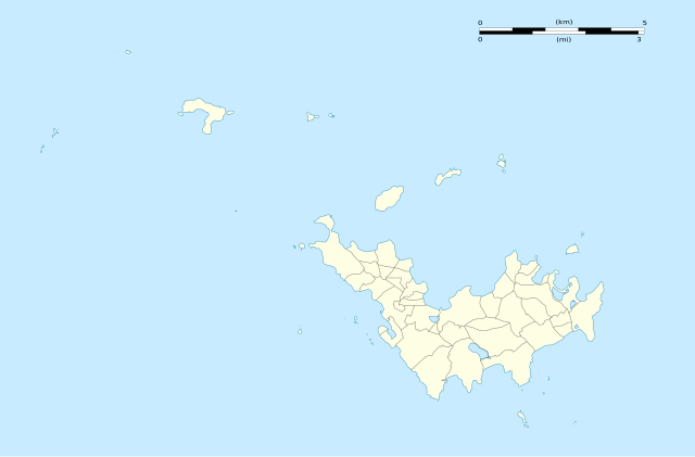
English: Blank administrative map of the overseas collectivity of Saint Barthélemy, France, with Quartiers boundaries, for geo-location purpose.
Français : Carte administrative vierge de la collectivité d'outre-mer de Saint-Barthélemy, France, avec limites des quartiers, destinée à la géolocalisation. Estimated scales: 1:200,000 (precision: 50 m)
Geographic limits of the map:
|
||
| Datum | |||
| Izvor |
Vlastito djelo
|
||
| Autor | Eric Gaba (Sting - fr:Sting) | ||
| Dopuštenje (Naknadno korištenje ove datoteke) |
|
||
| Ostale verzije |
|


Licenciranje
Eric Gaba, Wikimedia Commons user Sting, vlasnik autorskog prava ovog djela, ovdje ga objavljujem pod sljedećim licencama:
Ova datoteka je licencirana pod Creative Commons Attribution-Share Alike 3.0 neportiranom licencom.
Pripisivanje: Eric Gaba, Wikimedia Commons user Sting
- Slobodni ste:
- da dijelite – da kopirate, distributirate i prenosite djelo
- da remiksate – da prilagodite djelo
- Pod sljedećim uslovima:
- pripisivanje – Morate pripisati odgovarajuće autorske zasluge, osigurati link ka licenci i naznačiti jesu li napravljene izmjene. To možete uraditi na bilo koji razumni način, ali ne tako da se sugerira da davalac licence odobrava Vas ili Vašu upotrebu njegovog djela.
- dijeli pod istim uslovima – Ako mijenjate, transformišete ili nadograđujete ovaj materijal, morate ga objaviti i distribuirati samo pod istom ili sličnom licencom poput ove.

|
Dozvoljeno je kopirati, distribuirati i/ili mijenjati ovaj članak pod uslovima navedenim u GNU licenci za slobodnu dokumentaciju, verzija 1.2 ili kasnijom verzijom izdatom od Free Software Foundation; bez nepromjenljivih dijelova, te bez sadržaja na naslovnoj i zadnjoj strani. Kopija licence se nalazi pod poglavljem GNU Free Documentation License. |
Možete odabrati licencu po vašem izboru.
Historija datoteke
Kliknite na datum/vrijeme da vidite verziju datoteke iz tog vremena.
| Datum/vrijeme | Smanjeni pregled | Dimenzije | Korisnik | Komentar | |
|---|---|---|---|---|---|
| trenutno | 04:01, 26 februar 2010 | | 1.175 × 772 (135 KB) | Sting | == {{int:filedesc}} == {{Location|17|55|30|N|62|51|45|W|scale:50000}} <br/> {{Information |Description={{en|Blank administrative map of the overseas collectivity of Saint Barthélemy, [[:en:France|Fr |
Upotreba datoteke
Sljedeća stranica koristi ovu datoteku:
Globalna upotreba datoteke
Sljedeći wikiji koriste ovu datoteku:
- Upotreba na ar.wikipedia.org
- Upotreba na ast.wikipedia.org
- Upotreba na bg.wikipedia.org
- Upotreba na bn.wikipedia.org
- Upotreba na ceb.wikipedia.org
- Plantilya:Location map Saint Barthélemy
- West Channel
- South Channel
- Goat Island
- Sugarloaf
- Southeast Channel
- Canal du Sud
- Baie de Saint-Jean
- Saint Barthelemy
- Saint Bartholomew Island
- Saint-Barthélemy (pagklaro)
- Roches Rouges
- Roques (pagklaro)
- Île de la Pointe
- Le Pain de Sucre
- Canal de l'Ouest
- Pointe Nègre
- Pointe Negre
- Pointe Lézarde
- Les Saintes
- Les Islettes (pagklaro)
- Les Baleines
- Le Carénage
- La Tortue
- Île Tortue
- La Baleine (pagklaro)
- Roche Baleine
- Gustaf
- Grande Pointe
- Île Frégate
- Ile Fregate
- Îlet Frégate
- Fourche
- Pointe Colombier
- Ile Coco
- Barrel of Beef
- Le Boeuf
- Baie des Flamands
- Morne du Vitet
- Pointe à Toigny
- Île Toc Vers
- Roche Table
- Canal du Sud-Est
Pogledajte globalne upotrebe ove datoteke.