Datoteka:Map of New Caledonia and Noumea (cropped).jpg

Veličina ovog prikaza: 800 × 482 piksela. Ostale rezolucije: 320 × 193 piksela | 640 × 386 piksela | 1.147 × 691 piksela.
Izvorna datoteka (1.147 × 691 piksela, veličina datoteke: 142 KB, MIME tip: image/jpeg)
| Ova datoteka je s Wikimedia Commonsa. Opis s njene stranice opisa datoteke prikazan je ispod. Commons je skladište slobodnih medija i datoteka za sve projekte fondacije Wikimedia. Možete i Vi pomoći. |
Sažetak
| Opis |
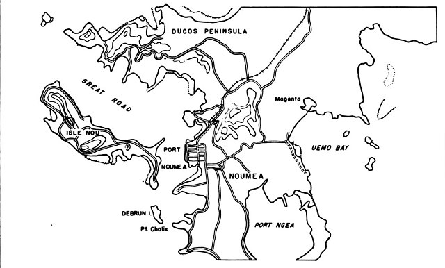
English: Map of New Caledonia and Noumea |
| Datum | |
| Izvor | Building the Navy's Bases in World War II, Volume II |
| Autor | United States Bureau of Yards and Docks |
| Ostale verzije |

.jpg)
Licenciranje
This work is in the public domain in the United States because it is a work prepared by an officer or employee of the United States Government as part of that person’s official duties under the terms of Title 17, Chapter 1, Section 105 of the US Code.
Note: This only applies to original works of the Federal Government and not to the work of any individual U.S. state, territory, commonwealth, county, municipality, or any other subdivision. This template also does not apply to postage stamp designs published by the United States Postal Service since 1978. (See § 313.6(C)(1) of Compendium of U.S. Copyright Office Practices). It also does not apply to certain US coins; see The US Mint Terms of Use.
|
 | |
| Ova datoteka je identificirana kao slobodna od poznatih ograničenja po zakonu o autorskim pravima, uključujući sva povezana i srodna prava. | ||
Historija datoteke
Kliknite na datum/vrijeme da vidite verziju datoteke iz tog vremena.
| Datum/vrijeme | Smanjeni pregled | Dimenzije | Korisnik | Komentar | |
|---|---|---|---|---|---|
| trenutno | 19:03, 5 april 2021 | | 1.147 × 691 (142 KB) | Zoozaz1 | File:Map of New Caledonia and Noumea.jpg cropped 58 % vertically using CropTool with precise mode. |
Upotreba datoteke
Sljedeće 2 stranice koriste ovu datoteku:
Globalna upotreba datoteke
Sljedeći wikiji koriste ovu datoteku:
- Upotreba na en.wikipedia.org
.jpg)