Datoteka:Istria Croatian Adriatic.png
Istria_Croatian_Adriatic.png (596 × 559 piksela, veličina datoteke: 84 KB, MIME tip: image/png)
| Ova datoteka je s Wikimedia Commonsa. Opis s njene stranice opisa datoteke prikazan je ispod. Commons je skladište slobodnih medija i datoteka za sve projekte fondacije Wikimedia. Možete i Vi pomoći. |
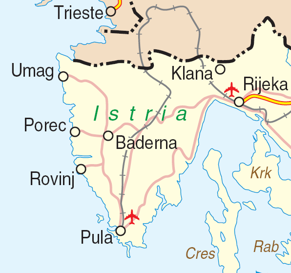
| Opis | Map of Istria, Croatia | |||
| Datum | ||||
| Izvor | http://www.un.org/Depts/Cartographic/map/profile/croatia.pdf | |||
| Autor | Department of Peacekeeping Operations Cartographic Section | |||
| Dopuštenje (Naknadno korištenje ove datoteke) |
|

Historija datoteke
Kliknite na datum/vrijeme da vidite verziju datoteke iz tog vremena.
| Datum/vrijeme | Smanjeni pregled | Dimenzije | Korisnik | Komentar | |
|---|---|---|---|---|---|
| trenutno | 18:59, 23 mart 2007 | | 596 × 559 (84 KB) | Minestrone | {{Information| |Description=Map of Istria, Croatia |Source=http://www.un.org/Depts/Cartographic/map/profile/croatia.pdf |Date=June, 2004 |Author=Department of Peacekeeping Operations Cartographic Section |Permission={{UN map}} }} |
Upotreba datoteke
Sljedeća stranica koristi ovu datoteku:
Globalna upotreba datoteke
Sljedeći wikiji koriste ovu datoteku:
- Upotreba na ceb.wikipedia.org
- Upotreba na de.wikipedia.org
- Upotreba na en.wikipedia.org
- Upotreba na hr.wikipedia.org
- Upotreba na it.wikivoyage.org
- Upotreba na www.wikidata.org